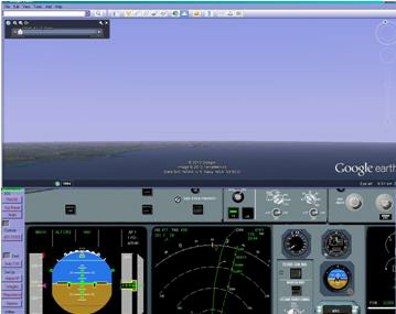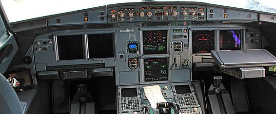
This optional extra takes advantage of the Google Earth’s ability to be driven in slave mode.
Positional information is passed from the simulation to a Google Earth running in a slave mode.
Thus the Google Earth view matches the current simulated aircraft’s position.
The Add On allows for 4 view points, forward, down left and right.
The A320 PC simulation is designed to be the core of a physical hardware flight simulation. As such the various components of I/O, Visual, Displays etc will be run on separate computers networked together.
As part of our cockpit development, we offer this separate overhead panel. It can be run on another networked computer, or if there is enough room on your screen ( or if you have multiple screens) it can be run on the same computer running the A320 PC simulation.
To set up the separate overhead panel simulation. please follow these instructions, as they are the same for the A330 PC sim
View out of the front window
View out of the Left/Right window window
View in map mode
Use real time “time of day” scene
Airbus A320 PC Simulation Optional Extras
Click on the pictures to download or press the required download button.
As part of our cockpit development, we offer this separate pedestal panel. It can be run on another networked computer, or if there is enough room on your screen ( or if you have multiple screens) it can be run on the same computer running the A320 PC simulation.
As part of our cockpit development, we offer this separate front panel. It can be
run on another networked computer, or if there is enough room on your screen ( or
if you have multiple screens) it can be run on the same computer running the A330-
When choosing to run the A330-
The VS Simulator Transceiver works by reading its corresponding ini file to determine what data it will send/receive and to which computer.
Full instructions for downloading, set up and running are given here.
Some knowledge of networks, IP addresses, and editing Ini files is required.
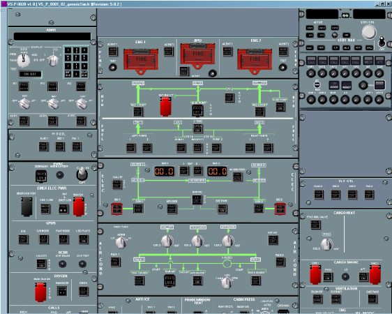
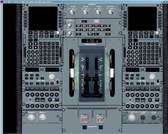
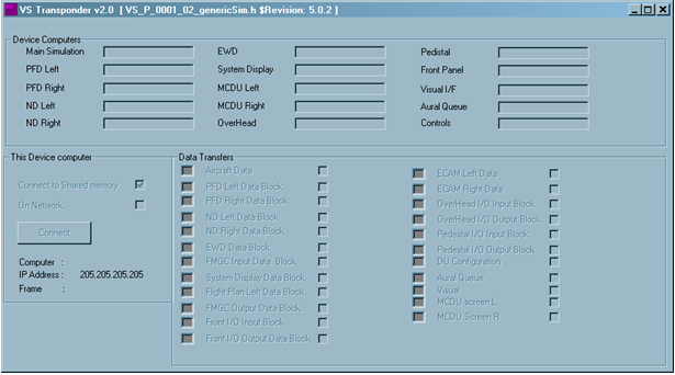
To set up the separate overhead panel simulation. please follow these instructions, as they are the same for the A330 PC sim
To set up the separate overhead panel simulation. please follow these instructions, as they are the same for the A330 PC sim
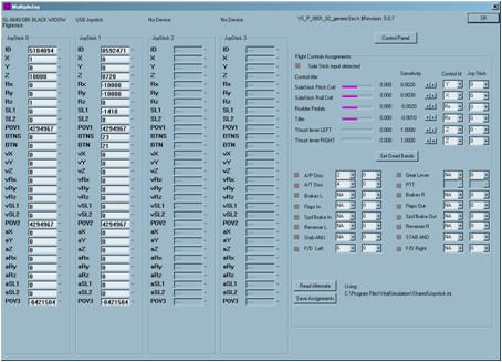
For users who have multiple joysticks, this interface tool may be used. It will allow the user to set up the joystick configuration for the A330 and A320 PC simulations. The User may set up the pitch, thrust, pedal, and some cockpit button controls as desired for up to 4 separate joysticks. The configuration is then saved to a joystick configuration file in “C:\Program Files\Vitalsimulation\Shared”. When the simulation program starts, it reads in this configuration file and assigns the joystick(s) controls accordingly. The user may also select and use another joystick configuration whilst the simulation program is running using this interface.
EGPWS Terrain On ND. This add on, provides a worldwide terrain map for the simulation. It will provide more accurate terrain heights and allow the Terrain On ND to function.
It does require a high capability CPU and Graphics CPU ability. Therefore the add on allows several options for Full, Half and Quarter models.
Please check the overall program timings at the bottom left hand side when running this add on. If there is significant frame over runs, ( indicated by the bar increasing ), then choose a less graphic intense option, so try Half instead of full, or Quarter instead of Half.
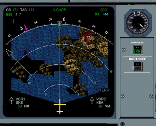
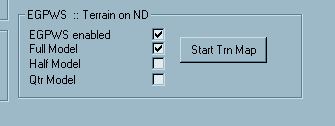
When downloaded, the EGPWS Options will appear in the Options dialog. Selecting the enable Option tick, will allow the separate world terrain program to run, providing the simulation with the ground map used for the Terrain on ND.
The Separate World Terrain program may be restarted by pressing the button “Start Trn Map” on the Options Dialog.
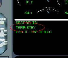
The Separate World Terrain program may loose contact with the simulation and close down. If it does so, the TERR STBY memo will be displayed.
The Separate World Terrain program may be restarted by pressing the button “Start Trn Map” on the Options Dialog.
The World Terrain program uses a 2000x4000 pixel representation of the terrain heights. Each tile is then sub divided to 3x3. Thus the resolution is about 3000 x 3000 m. For some airports, there may be a need for the use of virtual bulldozers, so the program will be updated from time to time with improved terrains for various airports.
Aircraft Traffic for TCAS model.
A data file containing some aircraft traffic can be downloaded from here.
