Approach


The approach phase begins when flying over the (DECEL) waypoint.
If entering the
initial approach area with HDG or Track, then the approach phase has to be entered
manually on the MCDU. This is done by selecting the approach prompt on the relevant
performance page and confirming the action.
Normally ATC will request specific speeds
and headings, but a fully automatic approach should be possible by letting the FMGS
guide the aircraft right up to the ILS intercept at an approach speed.
When cleared
by ATC, select the APP push button on the FCU. This will arm the G/S and LOC A/P
modes. At LOC and G/S capture the A/P will follow the ILS beam to the touchdown point.
During that descent, careful monitor of the aircraft speed , ILS deviation and aircraft
configuration needs to occur.

|
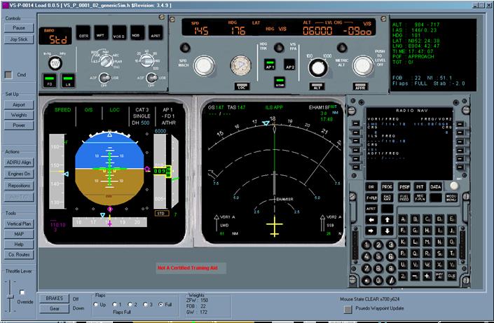
Here the aircraft is stabilized on the approach for Amsterdam Schiphol runway 18R
(FMGS Aid shown) |

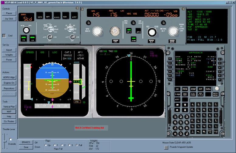
The ND may be selected to the ILS display using the Nav Control Panel (FMGS Aid shown)
A good approach speed for this model is about 180 to 190 knots flap 1 at about 2500
ft above runway altitude.
This is then followed by :
approx 2000 ft radio altitude FCU speed of 170 knots flap 2
approx 1800 ft radio altitude FCU speed of 150 knots flap 3
approx 1500 ft radio altitude FCU speed of VAPP (145 knots) flap land
approx 1100 ft radio altitude Gear down.
These are not necessarily representative of an A330-
Monitoring the Approach
|
Prior to LOC and G/S capture |
Check that the FMA shows CAT II or CAT III for the intended ILS approach. This will be in white in the 5th FMA column |
|
At 350 ft |
Check that LAND is annunciated on the FMA |
|
At 50 ft |
Check that FLARE is annunciated on the FMA |
|
At about 30ft |
Check that IDLE is annunciated for the thrust mode on the FMA And pull back the thrust levers to the idle position |
|
At touch down |
ROLL OUT mode engages. |
|
At touch down |
Disconnect the A/P when required |

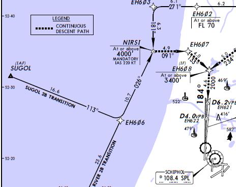
A section of the approach chart showing the left turn to NIRSI and then onto EH607 before aligning with runway 18R
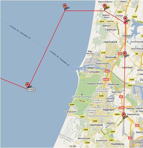
The same approach shown as the Google map of the waypoints with in the MCDU flight plan
Previous


